

About the Maps & Profiles
All of the "place" pages on this web site have a map, and most also have an elevation profile — but not all maps are created equal. This page lays out what to expect.
Destination icons
Most of the maps have one or more star icons ![]() )
)
Hiking maps
Most of the places detailed on Northwest Wildflowers are hikes or walks, with either one or two trailhead icons ![]() )
)
If a hike is a simple out-and-back (not a loop), then the elevation profile often shows a one-way trip, with only half of the total round-trip distance. For loops and lollipops, the full profile is generally shown. Note: Many places have multiple trails, and the maps shown here are only suggestions. There may be longer or shorter alternate routes available.
There are a few locations whose maps have no trailhead or profile, because there are either no defined trails (e.g., Kingston Prairie & Logan Valley), or a huge network of trails (e.g., Echo Ridge). Choose your own adventure.
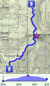
Two trailheads
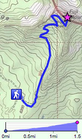
Out-and-back
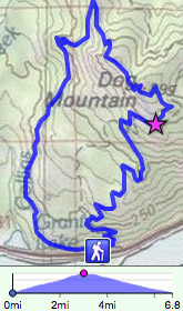
Loop trail
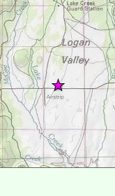
No specific trail
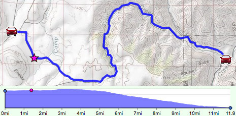
Driving maps
If the trailhead's "hiker" icon is replaced by a car icon ![]() )
)
Exporting GPS data
To export the track and trailheads from any map on Northwest Wildflowers, click on the menu icon ![]() )
)
